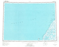
1951 Map of Black
USGS Topo · Published 1977About this map
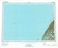
The Bering Sea coastline of western Alaska meets the complex distributary network of the Yukon River delta in this mid-century survey. The landscape is a labyrinth of water and silt, where the Black River winds through a vast marshland defined by shifting channels like Kwemeluk Pass and Nurukomarot Channel. Small settlements such as Waklarok, Bimiut, and Melatolik represent the sparse human footprint in this aqueous environment, situated where the land meets the tidal influence of the sea. Large areas of mud, flats, and shoals illustrate the dynamic nature of this coastline, where coastal islands like Krekatok Island and the Sand Islands stand as barriers against the open ocean. This 1950s data, compiled from USC&GS charts and Army Map Service surveys, provides a precise record of the intricate waterways including Acharon Pass and Kwikpak Pass before modern environmental shifts.
Find a feature on this map
21 named features on this map. Tap any name to fly to it.
Don’t see what you’re looking for? This feature index may not catch every label — zoom into the map to look around manually.
Map Details
Editions of this 1951 Black Map
6 editions found
Other maps of this area

1951 · Marshall
USGS Topo · 1:250,000

1951 · Hooper Bay
USGS Topo · 1:250,000

1951 · Black
USGS Topo · 1:250,000

1951 · St Michael
USGS Topo · 1:250,000

1952 · Kwiguk
USGS Topo · 1:250,000

1952 · Black A-2
USGS Topo · 1:63,360
1952 · Black C-1
USGS Topo · 1:63,360

1952 · Black A-1
USGS Topo · 1:63,360
1952 · Saint Michael A-6
USGS Topo · 1:63,360

1952 · Black B-1
USGS Topo · 1:63,360