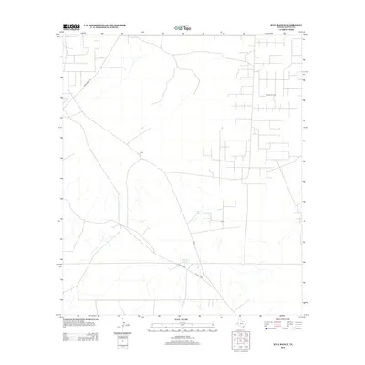
2012 Map of Kyle Ranch
USGS Topo · Published 2012About this map
Kyle Ranch and the industrial infrastructure of El Mar Oil Field define this portion of Loving County, Texas. This area is characterized by a sparse ranching landscape that has been overlaid with a complex grid of energy production access roads and utility lines. The reliance on water management in this arid environment is evident through the presence of Clifton Tank and Hackberry Tank, which serve as vital landmarks and resources. Transport through the territory is anchored by Ranch Road 652, with a network of local and private thoroughfares like Co Rd 2 and Pvt Road 3051 branching out to reach isolated well sites and ranch holdings. The map illustrates the specialized land use of the Permian Basin, where traditional livestock operations and modern petroleum extraction coexist.
Find a feature on this map
8 named features on this map. Tap any name to fly to it.
Don’t see what you’re looking for? This feature index may not catch every label — zoom into the map to look around manually.
Map Details
Editions of this 2012 Kyle Ranch Map
This is the sole edition of this map. No revisions or reprints were ever made.
Other maps of this area

1931 · Orla
USGS Topo · 1:62,500

1954 · Hobbs
USGS Topo · 1:250,000

1954 · Pecos
USGS Topo · 1:250,000

1957 · Pecos
USGS Topo · 1:250,000

1958 · Hobbs
USGS Topo · 1:250,000

1961 · Orla SE
USGS Topo · 1:24,000

1961 · Lindley Ranch
USGS Topo · 1:24,000

1968 · Orla NE
USGS Topo · 1:24,000

1968 · Phantom Banks
USGS Topo · 1:24,000

1969 · Kyle Ranch
USGS Topo · 1:24,000