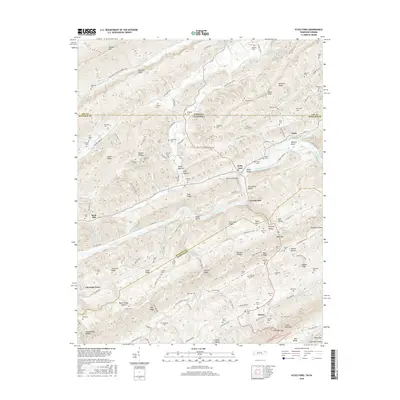
2016 Map of Kyles Ford
USGS Topo · Published 2016About this map
The Clinch River carves a deep valley through the ridges of Hancock Co and Hawkins Co in this 2016 survey of the Tennessee-Virginia border. This landscape is defined by its northeast-southwest mountain structure, where Newman Ridge and Copper Ridge overlook narrow farming valleys like Gravely Valley and Pumpkin Valley. The settlement of Kyles Ford sits at a critical crossing near Kyles Shoals, supported by the Kyles Ford Bridge and the historical pathway known as the Trl of the Lonesome Pine. Numerous family burial grounds, including the Wallen, Marcum, and Osborne cemeteries, are scattered across the slopes, marking generations of local ancestry. Industry and community life are tied to the water, as seen at Livesay Mill and the tight loops of Wallens Bend, while the small settlement of Eidson serves the southern reaches of Clinch Mountain.
Find a feature on this map
140 named features on this map. Tap any name to fly to it.
Don’t see what you’re looking for? This feature index may not catch every label — zoom into the map to look around manually.
Map Details
Editions of this 2016 Kyles Ford Map
This is the sole edition of this map. No revisions or reprints were ever made.
Other maps of this area

1883 · Morristown
USGS Topo · 1:125,000

1887 · Jonesville
USGS Topo · 1:125,000

1891 · Jonesville
USGS Topo · 1:125,000

1892 · Greeneville
USGS Topo · 1:125,000

1893 · Morristown
USGS Topo · 1:125,000

1894 · Estillville
USGS Topo · 1:125,000

1895 · Morristown
USGS Topo · 1:125,000

1896 · Greeneville
USGS Topo · 1:125,000

1904 · Greeneville
USGS Topo · 1:125,000

1935 · Surgoinsville
USGS Topo · 1:48,000