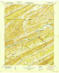
1950 Map of Kyles Ford
USGS Topo · Published 1950About this map
The Clinch River cuts a deep, winding path through a series of parallel ridges in this 1947 field examination, forming the geographic heart of Hancock County. The settlement at Kyles Ford serves as a central crossing point, while smaller hamlets like Eidson and Chestnut Grove are linked by rural routes, including the evocatively named The Trail of the Lonesome Pine. The landscape is densely populated with small-scale institutions that define early 20th-century Appalachian life, such as Sarepta Sch and Beech Grove Ch.
Find a feature on this map
107 named features on this map. Tap any name to fly to it.
Don’t see what you’re looking for? This feature index may not catch every label — zoom into the map to look around manually.
Map Details
Editions of this 1950 Kyles Ford Map
This is the sole edition of this map. No revisions or reprints were ever made.
Other maps of this area

1883 · Morristown
USGS Topo · 1:125,000

1887 · Jonesville
USGS Topo · 1:125,000

1891 · Jonesville
USGS Topo · 1:125,000

1892 · Greeneville
USGS Topo · 1:125,000

1893 · Morristown
USGS Topo · 1:125,000

1894 · Estillville
USGS Topo · 1:125,000

1895 · Morristown
USGS Topo · 1:125,000

1896 · Greeneville
USGS Topo · 1:125,000

1904 · Greeneville
USGS Topo · 1:125,000

1935 · Surgoinsville
USGS Topo · 1:48,000