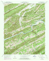
1969 Map of Kyles Ford
USGS Topo · Published 1970About this map
The Clinch River carves a deep path through the ridge-and-valley landscape of the Tennessee and Virginia border, defining the settlement patterns of this 1969 survey. Human activity is concentrated in the fertile lowlands of Huey Bottom and Kyle Valley, where local landmarks like Livesay Mill and Kyles Ford mark the intersection of river transport and rural industry. The map illustrates a dense network of family-named cemeteries and community institutions, such as the Lonesome Pine School and Davis Chapel, which served the scattered populations living between the steep slopes of Powell Mountain and Clinch Mountain.
Find a feature on this map
138 named features on this map. Tap any name to fly to it.
Don’t see what you’re looking for? This feature index may not catch every label — zoom into the map to look around manually.
Map Details
Editions of this 1969 Kyles Ford Map
This is the sole edition of this map. No revisions or reprints were ever made.
Other maps of this area

1883 · Morristown
USGS Topo · 1:125,000

1887 · Jonesville
USGS Topo · 1:125,000

1891 · Jonesville
USGS Topo · 1:125,000

1892 · Greeneville
USGS Topo · 1:125,000

1893 · Morristown
USGS Topo · 1:125,000

1894 · Estillville
USGS Topo · 1:125,000

1895 · Morristown
USGS Topo · 1:125,000

1896 · Greeneville
USGS Topo · 1:125,000

1904 · Greeneville
USGS Topo · 1:125,000

1935 · Surgoinsville
USGS Topo · 1:48,000