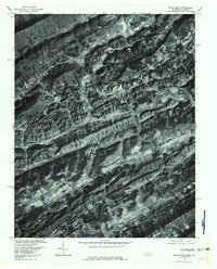
1976 Map of Kyles Ford
USGS Topo · Published 1981About this map
The Clinch River carves a winding path through this portion of Hancock County in the mid-1970s, defining a landscape of narrow valleys and ridges along the Tennessee-Virginia border. This orthophotoquad, prepared by the U.S. Geological Survey in cooperation with the Virginia Division of Mineral Resources, provides a rare photographic perspective of the rural settlement at Kyles Ford and the surrounding agricultural clearings. The terrain is marked by significant topographical breaks such as Flower Gap and Little War Gap, which historically dictated the flow of travel and commerce between the drainage basins. Along the water, smaller communities and named locales like Chestnut Grove and the curiously named Frog Level appear as clusters of activity near Blackwater Creek and War Creek, reflecting a settlement pattern deeply tied to the region's river-and-ridge geography.
Find a feature on this map
11 named features on this map. Tap any name to fly to it.
Don’t see what you’re looking for? This feature index may not catch every label — zoom into the map to look around manually.
Map Details
Editions of this 1976 Kyles Ford Map
This is the sole edition of this map. No revisions or reprints were ever made.
Other maps of this area

1883 · Morristown
USGS Topo · 1:125,000

1887 · Jonesville
USGS Topo · 1:125,000

1891 · Jonesville
USGS Topo · 1:125,000

1892 · Greeneville
USGS Topo · 1:125,000

1893 · Morristown
USGS Topo · 1:125,000

1894 · Estillville
USGS Topo · 1:125,000

1895 · Morristown
USGS Topo · 1:125,000

1896 · Greeneville
USGS Topo · 1:125,000

1904 · Greeneville
USGS Topo · 1:125,000

1935 · Surgoinsville
USGS Topo · 1:48,000