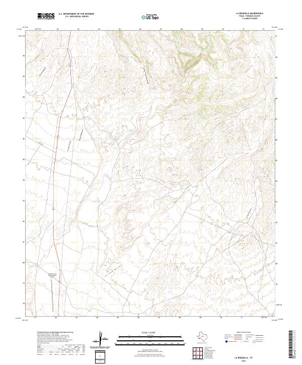
2022 Map of La Boquilla
USGS Topo · Published 2022About this map
Presidio Lely International Airport serves as a modern waypoint in this high-desert landscape, located just north of the border. This 2022 survey details a complex drainage system where ephemeral watercourses like Arroyo Chillon, Arroyo Mimbroso, and Arroyo Tinaja Escondido carve through the arid terrain toward the Cibolo Cr. The naming conventions reflect the region's deep cultural roots, with features such as Arroyo Monias and La Boquilla signifying the long-standing influence of the Spanish language in this part of Presidio County. Remote infrastructure is sparse, primarily limited to Garcia Rd and a handful of local connectors, highlighting a landscape where natural topography remains the dominant feature over human development.
Find a feature on this map
12 named features on this map. Tap any name to fly to it.
Don’t see what you’re looking for? This feature index may not catch every label — zoom into the map to look around manually.
Map Details
Editions of this 2022 La Boquilla Map
This is the sole edition of this map. No revisions or reprints were ever made.
Other maps of this area

1896 · Shafter
USGS Topo · 1:125,000

1959 · Presidio
USGS Topo · 1:250,000

1965 · Presidio
USGS Topo · 1:250,000

1978 · La Boquilla
USGS Topo · 1:24,000
1979 · Presidio West
USGS Topo · 1:24,000

1979 · Presidio East
USGS Topo · 1:24,000

1980 · Arroyo Melado
USGS Topo · 1:24,000

1983 · Shafter
USGS Topo · 1:24,000

1983 · Cerro Redondo
USGS Topo · 1:24,000

1983 · Cienega Mountains
USGS Topo · 1:24,000