
1979 Map of Presidio East
USGS Topo · Published 1979About this map
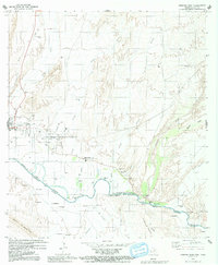
Fort Leaton State Historic Site anchors the riverbank of the Rio Grande Rio Bravo in this late 1970s study of the Texas-Chihuahua borderlands. The border town of Presidio is shown as a central transport node, where the Atchison Topeka and Santa Fe railroad crosses a landscape of irrigated fields and desert arroyos. The map details the transition from the irrigated valley floor to the desert uplands, including family and community sites such as Puliques and Campo Santo Estrada. Beyond the valley, the terrain rises into the Black Hills and the Cerros Las Cuchillas. The prominence of local Gaging Stations and pumping infrastructure reflects the vital importance of water management in this arid region, where Cibolo Creek and Alamito Creek drain toward the international boundary.
Find a feature on this map
37 named features on this map. Tap any name to fly to it.
Don’t see what you’re looking for? This feature index may not catch every label — zoom into the map to look around manually.
Map Details
Editions of this 1979 Presidio East Map
2 editions found
Other maps of this area

1896 · Polvo
USGS Topo · 1:125,000

1896 · Shafter
USGS Topo · 1:125,000

1959 · Presidio
USGS Topo · 1:250,000

1965 · Presidio
USGS Topo · 1:250,000
1971 · Redford
USGS Topo · 1:24,000

1978 · La Boquilla
USGS Topo · 1:24,000
1979 · Presidio West
USGS Topo · 1:24,000

1980 · Arroyo Melado
USGS Topo · 1:24,000

1983 · Cerro Redondo
USGS Topo · 1:24,000
1985 · Presidio
USGS Topo · 1:100,000