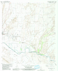
1979 Map of Presidio East
USGS Topo · Published 1991About this map
Rio Grande Bravo serves as the international boundary on this late 1970s survey, where the river valley supports a network of small settlements and irrigation infrastructure. The Texas side centers on Presidio, showing the local High Sch, several Water Tanks, and a Landing Strip to the north. Historical sites are prominent, including Fort Leaton State Historic Site and several burial grounds like Presidio Cem and Case Blanca Cem. South of the border in Chihuahua, Mexico, the landscape transitions from riverbank communities like El Zapatero.. and Puliques into the dramatic terrain of the Cerros Las Cuchillas. Numerous arroyos, including Arroyo Cibolo and Arroyo Tortola, carve through the arid high desert, while scattered Pumping Stations and wells indicate the vital importance of water management in this borderland corridor.
Find a feature on this map
43 named features on this map. Tap any name to fly to it.
Don’t see what you’re looking for? This feature index may not catch every label — zoom into the map to look around manually.
Map Details
Editions of this 1979 Presidio East Map
2 editions found
Other maps of this area

1896 · Polvo
USGS Topo · 1:125,000

1896 · Shafter
USGS Topo · 1:125,000

1959 · Presidio
USGS Topo · 1:250,000

1965 · Presidio
USGS Topo · 1:250,000
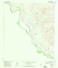
1971 · Redford
USGS Topo · 1:24,000

1978 · La Boquilla
USGS Topo · 1:24,000
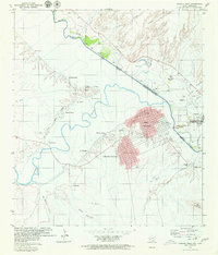
1979 · Presidio West
USGS Topo · 1:24,000

1979 · Presidio East
USGS Topo · 1:24,000

1980 · Arroyo Melado
USGS Topo · 1:24,000

1983 · Cerro Redondo
USGS Topo · 1:24,000