
1978 Map of La Boquilla
USGS Topo · Published 1978About this map
Cibolo Creek and its many seasonal tributaries dominate this high-desert landscape in Presidio County. The drainage network is characterized by deep erosional features like Arroyo Chillon and Arroyo Mimbroso, which cut through the arid terrain. Human presence is sparse, marked primarily by the isolated Arroyos Ranch and a series of survey benchmarks including Presidio North Base BM 3518 and Presidio South Base BM 3093, which served as critical control points for mapping the Texas borderlands.
Find a feature on this map
21 named features on this map. Tap any name to fly to it.
Don’t see what you’re looking for? This feature index may not catch every label — zoom into the map to look around manually.
Map Details
Editions of this 1978 La Boquilla Map
This is the sole edition of this map. No revisions or reprints were ever made.
Other maps of this area

1896 · Shafter
USGS Topo · 1:125,000

1959 · Presidio
USGS Topo · 1:250,000

1965 · Presidio
USGS Topo · 1:250,000
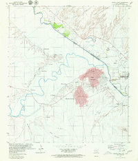
1979 · Presidio West
USGS Topo · 1:24,000

1979 · Presidio East
USGS Topo · 1:24,000

1980 · Arroyo Melado
USGS Topo · 1:24,000

1983 · Shafter
USGS Topo · 1:24,000

1983 · Cerro Redondo
USGS Topo · 1:24,000

1983 · Cienega Mountains
USGS Topo · 1:24,000
1985 · Presidio
USGS Topo · 1:100,000