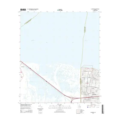
2015 Map of La Branche
USGS Topo · Published 2015About this map
Lake Pontchartrain dominates the northern expanse of this coastal landscape, meeting the marshy shoreline of La Branche where the waters of Bayou La Branche and Bayou Piquant filter through the wetlands. The transition from the natural hydrologic network to the dense residential expansion of Kenner is stark, with the city's suburban grid pressing against the eastern edge of the swamp. This 2015 survey illustrates the modern residential development pattern along the southern shore, defined by major thoroughfares such as W Esplanade Ave and Chateau Blvd. The map also captures the critical infrastructure of the region, showing the Walker Canal and the complex interchange systems that facilitate travel between the developed city and the low-lying coastal parishes to the west.
Find a feature on this map
82 named features on this map. Tap any name to fly to it.
Don’t see what you’re looking for? This feature index may not catch every label — zoom into the map to look around manually.
Map Details
Editions of this 2015 La Branche Map
This is the sole edition of this map. No revisions or reprints were ever made.
Other maps of this area

1891 · Hahnville
USGS Topo · 1:62,500

1891 · Spanish Fort
USGS Topo · 1:62,500

1891 · New Orleans
USGS Topo · 1:62,500

1892 · Bonnet Carre
USGS Topo · 1:62,500

1932 · New Orleans NW
USGS Topo · 1:31,680

1932 · Hahnville NW
USGS Topo · 1:31,680

1932 · Hahnville NE
USGS Topo · 1:31,680

1935 · Laplace
USGS Topo · 1:31,680

1935 · Luling
USGS Topo · 1:31,680

1936 · Hahnville
USGS Topo · 1:31,680