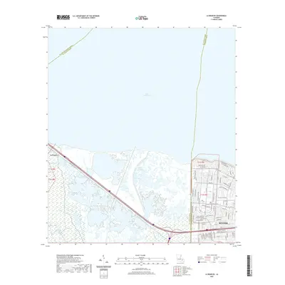
2020 Map of La Branche
USGS Topo · Published 2020About this map
Lake Pontchartrain dominates the northern landscape of this Jefferson Parish region, where the marshy wetlands of the Louisiana coast meet the suburban expansion of Kenner. The topography is defined by its complex hydrology, with Bayou Trepagnier, Bayou Piquant, and Bayou La Branche winding through the low-lying terrain south of the lake. This 2020 survey illustrates the sophisticated water management infrastructure required for the area, notably the Lower Guide Levee Rd and the Walker Canal. While the western portion remains dominated by open wetlands near the settlement of La Branche, the eastern edge reveals a dense grid of residential development including Woodlake Blvd and Saint Elizabeth Dr, showing the modern footprint of the Greater New Orleans area as it sits against the vast southern shoreline.
Find a feature on this map
81 named features on this map. Tap any name to fly to it.
Don’t see what you’re looking for? This feature index may not catch every label — zoom into the map to look around manually.
Map Details
Editions of this 2020 La Branche Map
This is the sole edition of this map. No revisions or reprints were ever made.
Other maps of this area

1891 · Hahnville
USGS Topo · 1:62,500

1891 · Spanish Fort
USGS Topo · 1:62,500

1891 · New Orleans
USGS Topo · 1:62,500

1892 · Bonnet Carre
USGS Topo · 1:62,500

1932 · New Orleans NW
USGS Topo · 1:31,680

1932 · Hahnville NW
USGS Topo · 1:31,680

1932 · Hahnville NE
USGS Topo · 1:31,680

1935 · Laplace
USGS Topo · 1:31,680

1935 · Luling
USGS Topo · 1:31,680

1936 · Hahnville
USGS Topo · 1:31,680