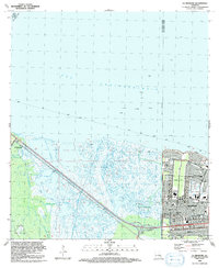
1992 Map of La Branche
USGS Topo · Published 1992About this map
Lake Pontchartrain dominates the northern horizon of this coastal landscape, where the transition from open water to marshland is defined by a series of protective levees and infrastructure. In the early 1990s, the southeastern corner of the map shows the suburban expansion of Kenner, including the planned layouts of Chateau Estates and the Jefferson Downs Racetrack. This developed area contrasts sharply with the expansive wetlands to the west, which are bisected by natural and man-made waterways like Bayou La Branche and Bayou Trepagnier.
Find a feature on this map
40 named features on this map. Tap any name to fly to it.
Don’t see what you’re looking for? This feature index may not catch every label — zoom into the map to look around manually.
Map Details
Editions of this 1992 La Branche Map
This is the sole edition of this map. No revisions or reprints were ever made.
Other maps of this area

1891 · Hahnville
USGS Topo · 1:62,500

1891 · Spanish Fort
USGS Topo · 1:62,500

1891 · New Orleans
USGS Topo · 1:62,500

1892 · Bonnet Carre
USGS Topo · 1:62,500

1932 · New Orleans NW
USGS Topo · 1:31,680

1932 · Hahnville NW
USGS Topo · 1:31,680

1932 · Hahnville NE
USGS Topo · 1:31,680

1935 · Laplace
USGS Topo · 1:31,680

1935 · Luling
USGS Topo · 1:31,680

1936 · Hahnville
USGS Topo · 1:31,680