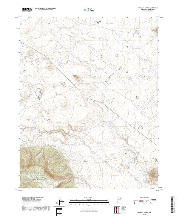
2023 Map of La Chata Crater
USGS Topo · Published 2023About this map
La Chata Crater sits at the center of this Mora County landscape, a distinctive volcanic landmark defining the high plains terrain north of the Turkey Mountains. The drainage patterns here are dictated by the presence of these uplands, with Gallinas Creek and Ciruela Creek cutting through the southern half of the sheet. To the southeast, the land rises again toward the flat-topped Jarosa Mesa. This 2023 survey illustrates a sparsely populated region primarily characterized by its geological features and watercourses like Arroyo Jarosa. The transition from the volcanic crater to the surrounding mesas provides a clear look at the local topography as it exists in the 21st century.
Find a feature on this map
7 named features on this map. Tap any name to fly to it.
Don’t see what you’re looking for? This feature index may not catch every label — zoom into the map to look around manually.
Map Details
Editions of this 2023 La Chata Crater Map
This is the sole edition of this map. No revisions or reprints were ever made.
Other maps of this area

1892 · Watrous
USGS Topo · 1:125,000

1894 · Watrous
USGS Topo · 1:125,000

1954 · Santa Fe
USGS Topo · 1:250,000

1954 · Raton
USGS Topo · 1:250,000

1958 · Raton
USGS Topo · 1:250,000

1958 · Santa Fe
USGS Topo · 1:250,000

1964 · Wagon Mound
USGS Topo · 1:24,000

1964 · Mogote Hills
USGS Topo · 1:24,000

1964 · Colmor
USGS Topo · 1:24,000

1966 · Mora Ranch
USGS Topo · 1:24,000