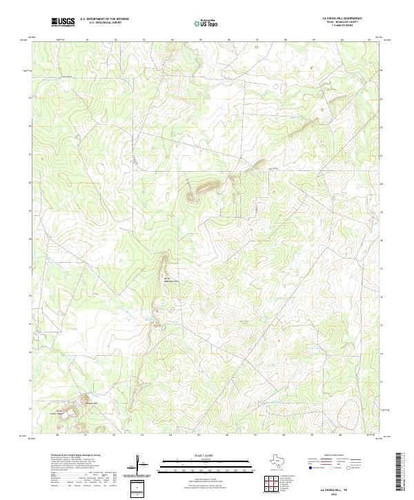
2022 Map of La Chusa Hill
USGS Topo · Published 2022About this map
Lachusa Hill and the surrounding rangeland of McMullen County define this south Texas landscape as it appeared in recent years. This area is characterized by a network of drainage creeks and seasonal water tanks essential for livestock and local wildlife, including Cow Cr, Hill Cr, and the extensive Devils Waterhole Cr system. The terrain is marked by distinctive elevations such as Devils Waterhole Hills and the flat-topped Devils Center Table. Human infrastructure is sparse, primarily consisting of private ranch roads like Caron Rd 889 and numerous water features such as Gueydan Tank and Pipeline Tank. This survey reflects a sparsely populated region where the environment remains shaped by the intersection of subtle topography and the management of water in an arid environment.
Find a feature on this map
16 named features on this map. Tap any name to fly to it.
Don’t see what you’re looking for? This feature index may not catch every label — zoom into the map to look around manually.
Map Details
Editions of this 2022 La Chusa Hill Map
This is the sole edition of this map. No revisions or reprints were ever made.
Other maps of this area

1920 · Mikeska
USGS Topo · 1:125,000

1929 · Simmons
USGS Topo · 1:62,500

1930 · Tilden
USGS Topo · 1:62,500

1937 · Loma Alta
USGS Topo · 1:62,500

1942 · Tilden
USGS Topo · 1:62,500

1953 · Crystal City
USGS Topo · 1:250,000

1955 · Crystal City
USGS Topo · 1:250,000

1961 · Crystal City
USGS Topo · 1:250,000

1968 · Crystal City
USGS Topo · 1:250,000
1969 · Live Oak Hollow
USGS Topo · 1:24,000