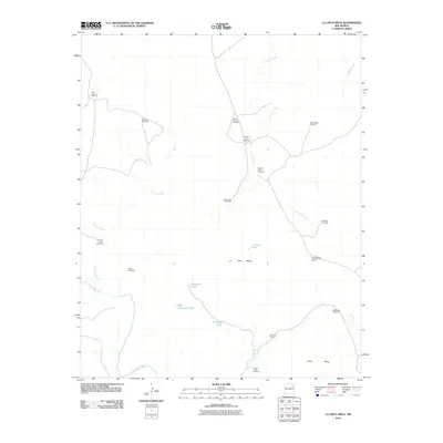
2010 Map of La Cinta Mesa
USGS Topo · Published 2010About this map
La Cinta Mesa and the nearby Chical Mesa anchor this landscape of the High Plains, where the Canadian River cuts through the southwestern corner of the terrain. The map reveals a land defined by its water management, centered on an extensive network of named windmills and tanks that supported the region's ranching economy. These features, ranging from the Old La Cinta Windmill to the New La Cinta Windmill, trace the development of water access across the San Miguel County range.
Find a feature on this map
26 named features on this map. Tap any name to fly to it.
Don’t see what you’re looking for? This feature index may not catch every label — zoom into the map to look around manually.
Map Details
Editions of this 2010 La Cinta Mesa Map
This is the sole edition of this map. No revisions or reprints were ever made.
Other maps of this area

1930 · Tucumcari
USGS Topo · 1:125,000

1954 · Santa Fe
USGS Topo · 1:250,000

1954 · Tucumcari
USGS Topo · 1:250,000

1958 · Santa Fe
USGS Topo · 1:250,000

1958 · Tucumcari
USGS Topo · 1:250,000

1967 · Tenaja Mesa
USGS Topo · 1:24,000

1967 · Monument Point
USGS Topo · 1:24,000

1968 · La Cinta Mesa
USGS Topo · 1:24,000

1968 · Carpenter Mesa SW
USGS Topo · 1:24,000

1968 · Carpenter Mesa NW
USGS Topo · 1:24,000