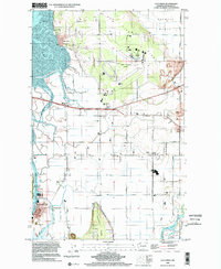
1998 Map of La Conner
USGS Topo · Published 2002About this map
La Conner serves as the focal point for this survey of the Skagit delta, positioned where the Swinomish Channel meets the intricate waterways of Fidalgo Island. The landscape is a testament to the region's agricultural and maritime legacy, defined by reclaimed lands and tidal flats. From the elevations of Bay View Ridge and Pleasant Ridge, the view extends across the fertile flats of Fir Island and the North Fork Skagit River. The map meticulously records the drainage network essential to this low-lying area, featuring Indian Slough, Telegraph Slough, and Higgins Slough.
Find a feature on this map
51 named features on this map. Tap any name to fly to it.
Don’t see what you’re looking for? This feature index may not catch every label — zoom into the map to look around manually.
Map Details
Editions of this 1998 La Conner Map
This is the sole edition of this map. No revisions or reprints were ever made.
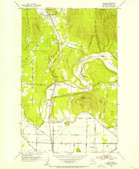
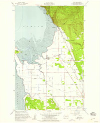
Other maps of this area

1911 · Mount Vernon
USGS Topo · 1:125,000

1918 · Samish Lake
USGS Topo · 1:62,500

1940 · Mt Vernon
USGS Topo · 1:62,500

1943 · Mt Vernon
USGS Topo · 1:62,500

1943 · Deception Pass
USGS Topo · 1:62,500

1943 · Anacortes
USGS Topo · 1:62,500

1951 · Deception Pass
USGS Topo · 1:62,500

1951 · Anacortes
USGS Topo · 1:62,500
1952 · Alger
USGS Topo · 1:24,000
1954 · Bow
USGS Topo · 1:24,000