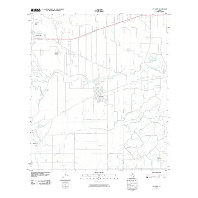
2010 Map of La Coste
USGS Topo · Published 2010About this map
The Castroville Historic District anchors the northwestern corner of this Medina County landscape, preserving the unique Alsatian-Texan heritage of a settlement founded along the Medina River. To the southeast, the town of La Coste sits as a prominent rail-oriented community on the Southern Pacific line. This survey captures a highly managed hydraulic environment where the Medina Irrigation Canal and Natalia Canal diverge from the river to feed the surrounding agriculture, a system vital to the area’s farming economy. Evidence of local community life is concentrated in the northern settlements, with landmarks like St Louis Cem, Castroville Cem, and the St Louis Ch providing significant points of interest for genealogical research. The terrain is characterized by the winding river valley and distinct elevations like Rhins Hill, while the Castroville Municipal Airport reflects more modern development.
Find a feature on this map
89 named features on this map. Tap any name to fly to it.
Don’t see what you’re looking for? This feature index may not catch every label — zoom into the map to look around manually.
Map Details
Editions of this 2010 La Coste Map
This is the sole edition of this map. No revisions or reprints were ever made.
Other maps of this area

1942 · Natalia
USGS Topo · 1:62,500

1953 · Culebra Hill
USGS Topo · 1:24,000

1953 · Macdona
USGS Topo · 1:24,000

1954 · San Antonio
USGS Topo · 1:250,000

1957 · San Antonio
USGS Topo · 1:250,000

1958 · La Coste
USGS Topo · 1:24,000

1958 · Somerset
USGS Topo · 1:24,000

1958 · La Coste NE
USGS Topo · 1:24,000

1964 · Riomedina
USGS Topo · 1:24,000

1964 · Castroville
USGS Topo · 1:24,000