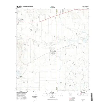
2016 Map of La Coste
USGS Topo · Published 2016About this map
Castroville and La Coste anchor this survey of the South Texas landscape, where the Medina River and its various tributaries define the local geography. The map reveals an intricate network of water management essential to the region's agricultural character, featuring the Medina Irrigation Canal and Natalia Canal alongside several named bodies of water like Alamo Angus Ranch Lake and Ruby Lake. This system reflects the historical reliance on irrigation to sustain the rural economy between the river forks.
Find a feature on this map
114 named features on this map. Tap any name to fly to it.
Don’t see what you’re looking for? This feature index may not catch every label — zoom into the map to look around manually.
Map Details
Editions of this 2016 La Coste Map
This is the sole edition of this map. No revisions or reprints were ever made.
Other maps of this area

1942 · Natalia
USGS Topo · 1:62,500

1953 · Culebra Hill
USGS Topo · 1:24,000

1953 · Macdona
USGS Topo · 1:24,000

1954 · San Antonio
USGS Topo · 1:250,000

1957 · San Antonio
USGS Topo · 1:250,000

1958 · La Coste
USGS Topo · 1:24,000

1958 · Somerset
USGS Topo · 1:24,000

1958 · La Coste NE
USGS Topo · 1:24,000

1964 · Riomedina
USGS Topo · 1:24,000

1964 · Castroville
USGS Topo · 1:24,000