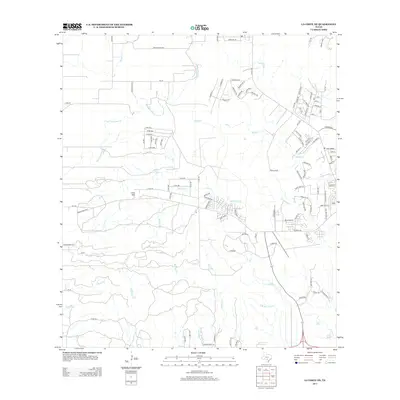
2013 Map of La Coste NE
USGS Topo · Published 2013About this map
San Geronimo Cr and Medio Cr define the northern drainage of this Bexar County landscape, where the outskirts of San Antonio’s suburban expansion meet established rural landmarks. The terrain is marked by significant hydrological features such as San Lucas Springs and the winding course of Potranca Cr. Local navigation is anchored by named locations like Loma Alta and Louis Agusta, reflecting a mix of historic settlement names and modern residential development. The southern portion of the map is dominated by the complex network of Big Sous Cr and its tributaries, including E Br Big Sous Cr and Little Sous Cr. The presence of several county roads and private ways, such as Co RD-374 and Zinsmeyer Ln, highlights the transition from open ranchland to more structured parcels in this part of South Central Texas.
Find a feature on this map
117 named features on this map. Tap any name to fly to it.
Don’t see what you’re looking for? This feature index may not catch every label — zoom into the map to look around manually.
Map Details
Editions of this 2013 La Coste NE Map
This is the sole edition of this map. No revisions or reprints were ever made.
Other maps of this area

1953 · Culebra Hill
USGS Topo · 1:24,000

1953 · Macdona
USGS Topo · 1:24,000

1953 · Helotes
USGS Topo · 1:24,000

1954 · San Antonio
USGS Topo · 1:250,000

1956 · Medina Lake
USGS Topo · 1:62,500

1957 · San Antonio
USGS Topo · 1:250,000

1958 · La Coste
USGS Topo · 1:24,000

1958 · La Coste NE
USGS Topo · 1:24,000

1964 · Riomedina
USGS Topo · 1:24,000

1964 · Castroville
USGS Topo · 1:24,000