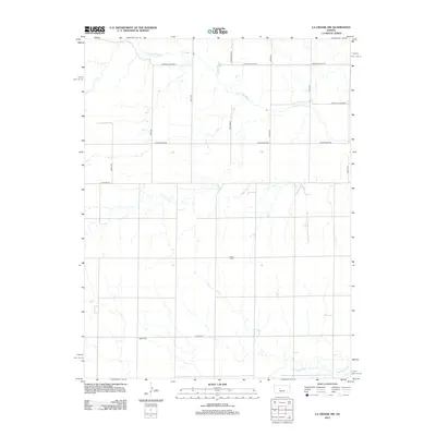
2012 Map of La Crosse NW
USGS Topo · Published 2012About this map
The Smoky Hill River meanders across this rural section of Ellis County, defining the drainage patterns of a landscape marked by straight section-line roads and scattered agricultural homesteads. The terrain transitions from the river valley in the north toward the seasonal drainage of Big Timber Cr in the southeast. Cultural markers for genealogists and local historians are preserved in the locations of the Cordial Cem and the Nickel Cem, which sit amidst the grid of country roads like Schoenchen Rd and Chetolah Gold Rd. These roads and landmarks reflect the enduring settlement patterns of the High Plains, where naming conventions like Yocemento Ave point toward the regional significance of past industries and nearby communities in this expansive Kansas landscape.
Find a feature on this map
17 named features on this map. Tap any name to fly to it.
Don’t see what you’re looking for? This feature index may not catch every label — zoom into the map to look around manually.
Map Details
Editions of this 2012 La Crosse NW Map
This is the sole edition of this map. No revisions or reprints were ever made.
Other maps of this area

1893 · Ellis
USGS Topo · 1:125,000

1896 · Hays
USGS Topo · 1:125,000

1955 · Great Bend
USGS Topo · 1:250,000

1957 · Great Bend
USGS Topo · 1:250,000

1958 · Great Bend
USGS Topo · 1:250,000

1961 · Hays South
USGS Topo · 1:24,000

1961 · Antonino
USGS Topo · 1:24,000

1965 · Mc Cracken
USGS Topo · 1:24,000

1966 · La Crosse
USGS Topo · 1:24,000

1966 · Hargrave
USGS Topo · 1:24,000