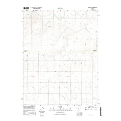
2015 Map of La Crosse NW
USGS Topo · Published 2015About this map
The Smoky Hill River meanders through the northern reaches of this High Plains landscape, defining the transition between the agricultural uplands and the river valley. This 2015 survey illustrates the enduring grid of the Public Land Survey System, where roads like Schoenchen Rd and Chetolah Gold Rd follow section lines across the Ellis and Rush County border. For those tracing local heritage, the map identifies small, isolated burial sites such as Cordial Cem and Nickel Cem, which stand as quiet markers of early settlement patterns in this part of Kansas. The southern portion of the sheet is drained by Big Timber Cr, showing a more dissected terrain than the broad flats found further north. This detailed topographic record provides a precise look at the rural infrastructure and physical geography at the county line during the early twenty-first century.
Find a feature on this map
33 named features on this map. Tap any name to fly to it.
Don’t see what you’re looking for? This feature index may not catch every label — zoom into the map to look around manually.
Map Details
Editions of this 2015 La Crosse NW Map
This is the sole edition of this map. No revisions or reprints were ever made.
Other maps of this area

1893 · Ellis
USGS Topo · 1:125,000

1896 · Hays
USGS Topo · 1:125,000

1955 · Great Bend
USGS Topo · 1:250,000

1957 · Great Bend
USGS Topo · 1:250,000

1958 · Great Bend
USGS Topo · 1:250,000

1961 · Hays South
USGS Topo · 1:24,000

1961 · Antonino
USGS Topo · 1:24,000

1965 · Mc Cracken
USGS Topo · 1:24,000

1966 · La Crosse
USGS Topo · 1:24,000

1966 · Hargrave
USGS Topo · 1:24,000