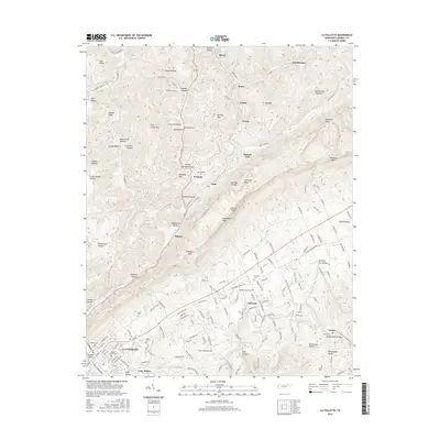
2016 Map of La Follette
USGS Topo · Published 2016About this map
La Follette serves as the hub of this region, where the town's grid meets the rising slopes of Walden Hollow and Russell Ridge. The landscape is defined by the sharp transition between the developed valley floor and the narrow gaps of the Cumberland Mountain range. Smaller settlements such as Peabody, Duff, and Kilsyth follow the corridors carved by the terrain, illustrating a settlement pattern dictated by the steep topography of Brushy Mtn and Log Mtn.
Find a feature on this map
178 named features on this map. Tap any name to fly to it.
Don’t see what you’re looking for? This feature index may not catch every label — zoom into the map to look around manually.
Map Details
Editions of this 2016 La Follette Map
This is the sole edition of this map. No revisions or reprints were ever made.
Other maps of this area

1886 · Cumberland Gap
USGS Topo · 1:125,000

1888 · Cumberland Gap
USGS Topo · 1:125,000

1890 · Williamsburg
USGS Topo · 1:125,000

1891 · Cumberland Gap
USGS Topo · 1:125,000

1893 · Briceville
USGS Topo · 1:125,000

1894 · Williamsburg
USGS Topo · 1:125,000

1895 · Briceville
USGS Topo · 1:125,000

1896 · Briceville
USGS Topo · 1:125,000

1897 · Maynardville
USGS Topo · 1:125,000

1900 · Maynardville
USGS Topo · 1:125,000