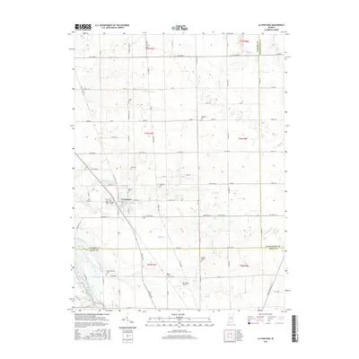
2016 Map of La Fontaine
USGS Topo · Published 2016About this map
La Fontaine serves as the primary hub in this portion of Wabash County, where the local street grid including E Kendall St meets several regional routes. The surrounding landscape is defined by an intricate network of waterways, with Grant Cr and its northern branch cutting through the central terrain while Metocinah Cr and Badger Cr flow toward the southwest. These creek systems historically influenced the placement of numerous small family and community burial grounds, such as Stone Cem and Rennaker Cem. To the south, the settlement of Fox and the Fox Station Airport mark the transition toward Grant County, near where Metocinah Cr nears the Mississinewa River. The density of named cemeteries like Meshingomesia Cem and America Cem suggests a long-established rural population and offers significant points of interest for genealogical research in the region.
Find a feature on this map
95 named features on this map. Tap any name to fly to it.
Don’t see what you’re looking for? This feature index may not catch every label — zoom into the map to look around manually.
Map Details
Editions of this 2016 La Fontaine Map
This is the sole edition of this map. No revisions or reprints were ever made.
Other maps of this area

1950 · Lagro
USGS Topo · 1:24,000

1950 · Andrews
USGS Topo · 1:24,000

1950 · Mount Etna
USGS Topo · 1:24,000

1951 · Mount Etna
USGS Topo · 1:24,000

1951 · Andrews
USGS Topo · 1:24,000

1951 · Lagro
USGS Topo · 1:24,000

1952 · Wabash
USGS Topo · 1:24,000

1953 · La Fontaine
USGS Topo · 1:24,000

1953 · Somerset
USGS Topo · 1:24,000

1953 · Muncie
USGS Topo · 1:250,000