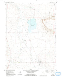
1960 Map of La Grange
USGS Topo · Published 1993About this map
La Grange stands as the primary settlement in this corner of southeastern Wyoming, situated where Bear Creek joins the valley landscape. The mapping reflects a region defined by its water management, centered on the Hawk Springs Reservoir and a network of irrigation channels including the Hawk Springs Ditch and Wycross Ditch. These systems support local operations like Wycross Ranch and the community at Wycross, illustrating the vital role of water rights in the High Plains ranching economy.
Find a feature on this map
23 named features on this map. Tap any name to fly to it.
Don’t see what you’re looking for? This feature index may not catch every label — zoom into the map to look around manually.
Map Details
Editions of this 1960 La Grange Map
2 editions found
Other maps of this area

1899 · Goshen Hole
USGS Topo · 1:125,000

1954 · Cheyenne
USGS Topo · 1:250,000

1958 · Cheyenne
USGS Topo · 1:250,000

1960 · Tremain
USGS Topo · 1:24,000

1960 · Mc Compsey Pass
USGS Topo · 1:24,000

1960 · Petsch Reservoir
USGS Topo · 1:24,000

1960 · Hawk Springs
USGS Topo · 1:24,000

1960 · Kessler Gap
USGS Topo · 1:24,000

1960 · Meriden
USGS Topo · 1:24,000

1960 · La Grange
USGS Topo · 1:24,000