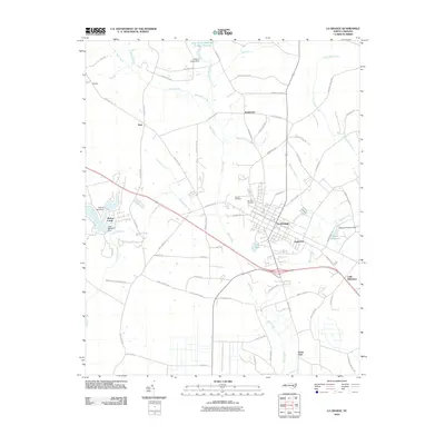
2010 Map of La Grange
USGS Topo · Published 2010About this map
La Grange stands as the central hub of this eastern North Carolina landscape, where the confluence of residential streets and rural corridors meets a network of vital waterways. The drainage patterns of Bear Creek and Moseley Creek define the agricultural layout, while industrial and historical water-management sites like Walters Millpond and the Walters Millpond Dam point to the area's long-standing reliance on local milling operations. Smaller settlements like Eastwood, Shadetown, and Little Baltimore are scattered along the periphery, connected by an extensive grid of farm-to-market roads such as Rouse Chapel Rd and Institute Rd.
Find a feature on this map
73 named features on this map. Tap any name to fly to it.
Don’t see what you’re looking for? This feature index may not catch every label — zoom into the map to look around manually.
Map Details
Editions of this 2010 La Grange Map
This is the sole edition of this map. No revisions or reprints were ever made.
Other maps of this area

1914 · Kinston
USGS Topo · 1:48,000

1916 · Kinston
USGS Topo · 1:62,500

1953 · Rocky Mount
USGS Topo · 1:250,000

1954 · Rocky Mount
USGS Topo · 1:250,000

1957 · Goldsboro
USGS Topo · 1:62,500

1957 · Seven Springs
USGS Topo · 1:62,500

1958 · Deep Run
USGS Topo · 1:62,500

1980 · Seven Springs
USGS Topo · 1:24,000
1980 · Deep Run
USGS Topo · 1:24,000
1980 · Williams
USGS Topo · 1:24,000