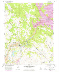
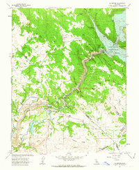
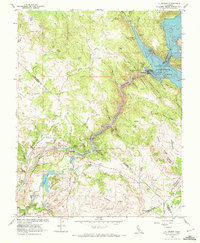
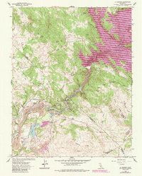
1962 Map of La Grange
USGS Topo · Published 1978About this map
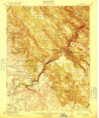
La Grange stands as the primary settlement on this landscape where the Tuolumne River emerges from the Sierra foothills into the Central Valley. The map documents an area defined by heavy industrial modification and water management, featuring extensive Dredge Tailings along the riverbanks and the complex infrastructure of the Modesto Main Canal and Turlock Main Canal. These features, alongside the La Grange Reservoir and the massive Don Pedro Reservoir to the northeast, illustrate the region's historical role in California's hydraulic mining and irrigation development.
Find a feature on this map
73 named features on this map. Tap any name to fly to it.
Don’t see what you’re looking for? This feature index may not catch every label — zoom into the map to look around manually.
Map Details
Editions of this 1962 La Grange Map
4 editions found
Other maps of this area

1893 · Sonora
USGS Topo · 1:125,000

1896 · Sonora
USGS Topo · 1:125,000

1897 · Sonora
USGS Topo · 1:125,000

1898 · Sonora
USGS Topo · 1:125,000

1913 · Dickenson
USGS Topo · 1:31,680

1915 · La Grange
USGS Topo · 1:24,000

1916 · Three Tree Flat
USGS Topo · 1:31,680

1916 · Cooperstown
USGS Topo · 1:31,680
1916 · Copperopolis
USGS Topo · 1:62,500

1916 · Merced Falls
USGS Topo · 1:24,000