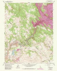
1962 Map of La Grange
USGS Topo · Published 1987About this map
The Tuolumne River carves through this landscape at the junction of Stanislaus, Tuolumne, Mariposa, and Merced counties. The historic settlement of La Grange sits at the heart of the region, surrounded by a terrain heavily shaped by industrial and water management efforts. Extensive Dredge Tailings along the riverbank downstream from town testify to the scale of past gold mining operations, while the Mitchell Mine further north hints at earlier prospecting.
Find a feature on this map
55 named features on this map. Tap any name to fly to it.
Don’t see what you’re looking for? This feature index may not catch every label — zoom into the map to look around manually.
Map Details
Editions of this 1962 La Grange Map
4 editions found
Other maps of this area

1893 · Sonora
USGS Topo · 1:125,000

1896 · Sonora
USGS Topo · 1:125,000

1897 · Sonora
USGS Topo · 1:125,000

1898 · Sonora
USGS Topo · 1:125,000

1913 · Dickenson
USGS Topo · 1:31,680

1915 · La Grange
USGS Topo · 1:24,000

1916 · Three Tree Flat
USGS Topo · 1:31,680

1916 · Cooperstown
USGS Topo · 1:31,680

1916 · Copperopolis
USGS Topo · 1:62,500

1916 · Merced Falls
USGS Topo · 1:24,000