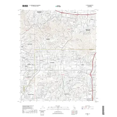
2018 Map of La Habra
USGS Topo · Published 2018About this map
Puente Hills and the surrounding ridges of the West Coyote Hills and East Coyote Hills define the geography of this 2018 survey. The landscape is a dense suburban matrix where residential developments in Hacienda Heights and La Habra Heights press into the steep canyons. While the lowlands are almost entirely built out across La Habra, Whittier, and Fullerton, the map preserves the location of older named areas like Des Moines and Leffingwell. A sophisticated network of recreational paths, including the Schabarum Skyline Trail and Purple Sage Trail, winds through Powder Canyon, illustrating the modern conversion of these steep uplands into a regional park system. Further south, significant institutional footprints are visible at California State Univ Fullerton and the Southern California Univ of Health Sciences.
Find a feature on this map
52 named features on this map. Tap any name to fly to it.
Don’t see what you’re looking for? This feature index may not catch every label — zoom into the map to look around manually.
Map Details
Editions of this 2018 La Habra Map
This is the sole edition of this map. No revisions or reprints were ever made.
Other maps of this area

1894 · Los Angeles
USGS Topo · 1:62,500

1894 · Pomona
USGS Topo · 1:62,500

1896 · Pasadena
USGS Topo · 1:62,500

1896 · Anaheim
USGS Topo · 1:62,500

1896 · Downey
USGS Topo · 1:62,500

1897 · Pomona
USGS Topo · 1:62,500

1898 · Pomona
USGS Topo · 1:62,500

1898 · Anaheim
USGS Topo · 1:62,500

1899 · Downey
USGS Topo · 1:62,500

1900 · Pasadena
USGS Topo · 1:62,500