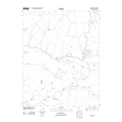
2012 Map of La Honda
USGS Topo · Published 2012About this map
La Honda sits at the heart of this coastal mountain landscape, where the confluence of La Honda Cr and San Gregorio Cr once supported early timber and ranching operations. The map documents a dense network of private camps and small settlements, including Redwood Terrace, Loma Mar, and Dearborn Park, indicating the area's long-standing transition from industry to seasonal and permanent mountain residences. Notable for its many small water bodies and family-named landmarks, the terrain features sites like Reflection Lake, Pearsons Pond, and Big Lagoon. Local geography is further defined by idiosyncratic place names such as The Potato Patch and Big Chicken Hollow, while historical transit and access are visible along the winding Old La Honda Rd and Sears Ranch Rd.
Find a feature on this map
94 named features on this map. Tap any name to fly to it.
Don’t see what you’re looking for? This feature index may not catch every label — zoom into the map to look around manually.
Map Details
Editions of this 2012 La Honda Map
This is the sole edition of this map. No revisions or reprints were ever made.
Other maps of this area

1897 · Palo Alto
USGS Topo · 1:62,500

1899 · Palo Alto
USGS Topo · 1:62,500

1902 · Santa Cruz
USGS Topo · 1:125,000

1940 · Halfmoon Bay
USGS Topo · 1:62,500

1940 · Ano Nuevo
USGS Topo · 1:62,500

1941 · Ano Nuevo Pt.
USGS Topo · 1:62,500

1941 · Palo Alto
USGS Topo · 1:62,500

1942 · Ano Nuevo
USGS Topo · 1:62,500

1943 · Palo Alto
USGS Topo · 1:62,500

1943 · Halfmoon Bay
USGS Topo · 1:62,500