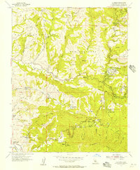
1955 Map of La Honda
USGS Topo · Published 1957About this map
Deep within the Santa Cruz Mountains during the mid-1950s, La Honda serves as a hub for community life and recreation in southern San Mateo County. This survey reveals a landscape of wooded canyons and ridges, notably around Memorial Park and Dearborn Park. Educational and youth-oriented sites are prominent throughout these hills, including the Woodhaven Girl Scout Camp, SF Log Cabin Boys School, and both the Oakland YMCA Camp and San Francisco YMCA Camp. While the Bellvale School is noted as abandoned by this date, new infrastructure like the Pomponio Reservoir indicates changing land use. Economic activities are scattered across the terrain, from the Milky Lane Dairy in the south to several oil wells and oil test wells located along the creeks. Small clusters of settlement like Loma Mar and Redwood Terrace dot the winding roads connecting Pescadero Road to the ridges above.
Find a feature on this map
64 named features on this map. Tap any name to fly to it.
Don’t see what you’re looking for? This feature index may not catch every label — zoom into the map to look around manually.
Map Details
Editions of this 1955 La Honda Map
This is the sole edition of this map. No revisions or reprints were ever made.
Other maps of this area

1897 · Palo Alto
USGS Topo · 1:62,500

1899 · Palo Alto
USGS Topo · 1:62,500

1902 · Santa Cruz
USGS Topo · 1:125,000

1940 · Halfmoon Bay
USGS Topo · 1:62,500

1940 · Ano Nuevo
USGS Topo · 1:62,500

1941 · Ano Nuevo Pt.
USGS Topo · 1:62,500

1941 · Palo Alto
USGS Topo · 1:62,500

1942 · Ano Nuevo
USGS Topo · 1:62,500

1943 · Palo Alto
USGS Topo · 1:62,500

1943 · Halfmoon Bay
USGS Topo · 1:62,500