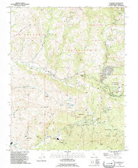
1991 Map of La Honda
USGS Topo · Published 1995About this map
La Honda and its surrounding communities in the Santa Cruz Mts are defined by a complex landscape of creek drainages and ridges as they appeared in the early 1990s. The settlement pattern here is characterized by isolated clusters of development like Redwood Terrace and Loma Mar, interspersed with specialized institutions such as the Glenwood Boys Ranch and Woodhaven Camp. Water management and natural features dominate the interior, with Reflection Lake near the town center and the Pomponio Reservoir situated further west among the ridges. Notable industrial traces include Oil Wells located south of Kingston Cr, suggesting the historical extraction efforts in this part of San Mateo County. The map also records several family-named landmarks and distinct geological features like the Goat Hill Chalks and Burns Chalks, alongside the extensive network of local parks such as Memorial County Park and Sam McDonald County Park.
Find a feature on this map
86 named features on this map. Tap any name to fly to it.
Don’t see what you’re looking for? This feature index may not catch every label — zoom into the map to look around manually.
Map Details
Editions of this 1991 La Honda Map
This is the sole edition of this map. No revisions or reprints were ever made.
Other maps of this area

1897 · Palo Alto
USGS Topo · 1:62,500

1899 · Palo Alto
USGS Topo · 1:62,500

1902 · Santa Cruz
USGS Topo · 1:125,000
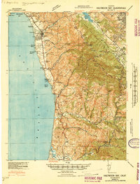
1940 · Halfmoon Bay
USGS Topo · 1:62,500

1940 · Ano Nuevo
USGS Topo · 1:62,500

1941 · Ano Nuevo Pt.
USGS Topo · 1:62,500

1941 · Palo Alto
USGS Topo · 1:62,500
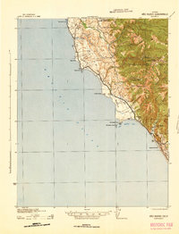
1942 · Ano Nuevo
USGS Topo · 1:62,500

1943 · Palo Alto
USGS Topo · 1:62,500

1943 · Halfmoon Bay
USGS Topo · 1:62,500