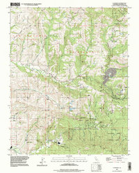
1997 Map of La Honda
USGS Topo · Published 1999About this map
San Mateo County timberlands and coastal ridges define this 1990s topographic survey, centered on the community of La Honda. The landscape is a network of deep gulches and creek valleys, including the drainages of San Gregorio Creek and Pescadero Creek, where numerous camps and ranches are tucked into the redwood-shaded terrain. Notable institutional and recreational sites include the San Francisco Log Cabin Ranch, Glenwood Boys Ranch, and the expansive grounds of Memorial County Park. Settlement patterns reflect a mix of small residential clusters like Redwood Terrace and Loma Mar, alongside working landscapes marked by oil wells and gaging stations. The mapping also details significant geologic features such as Butano Ridge, the Burns Chalks, and the Pomponio Reservoir, illustrating the complex water management and rugged topography of the Santa Cruz Mountains.
Find a feature on this map
78 named features on this map. Tap any name to fly to it.
Don’t see what you’re looking for? This feature index may not catch every label — zoom into the map to look around manually.
Map Details
Editions of this 1997 La Honda Map
This is the sole edition of this map. No revisions or reprints were ever made.
Other maps of this area

1897 · Palo Alto
USGS Topo · 1:62,500

1899 · Palo Alto
USGS Topo · 1:62,500

1902 · Santa Cruz
USGS Topo · 1:125,000

1940 · Halfmoon Bay
USGS Topo · 1:62,500

1940 · Ano Nuevo
USGS Topo · 1:62,500

1941 · Ano Nuevo Pt.
USGS Topo · 1:62,500

1941 · Palo Alto
USGS Topo · 1:62,500

1942 · Ano Nuevo
USGS Topo · 1:62,500

1943 · Palo Alto
USGS Topo · 1:62,500

1943 · Halfmoon Bay
USGS Topo · 1:62,500