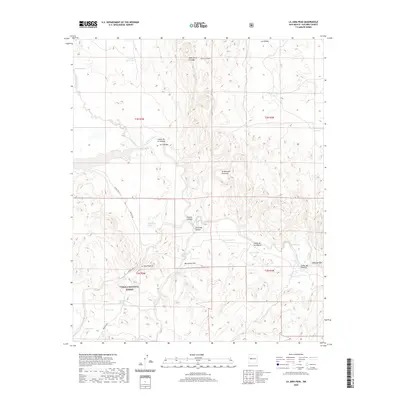
2020 Map of La Jara Peak
USGS Topo · Published 2020About this map
Cibola National Forest encompasses a significant portion of this landscape, where the high desert meets the volcanic and sedimentary formations of Socorro County. The topography is defined by prominent elevations such as La Jara Peak and Monument Hill, which overlook a complex system of drainage and seasonal water sources essential to this arid environment. The presence of numerous watering points, including Juan De Dios Tank, Mina Tank, and Bull Tank, alongside traditional springs like El Chupadero Spring and La Jara Spring, suggests a history of livestock grazing and land management. The winding path of the Rio Salado cuts through the terrain, fed by canyons like Carrizozo Canyon and Cañon de los Negros. Access to this remote area is provided by unpaved routes such as Buricito Rd and Forest Rd 123, which navigate the mesas and basins between Sierra Lucero and Los Pilares.
Find a feature on this map
34 named features on this map. Tap any name to fly to it.
Don’t see what you’re looking for? This feature index may not catch every label — zoom into the map to look around manually.
Map Details
Editions of this 2020 La Jara Peak Map
This is the sole edition of this map. No revisions or reprints were ever made.
Other maps of this area

1917 · Cerro Verde
USGS Topo · 1:125,000

1954 · Socorro
USGS Topo · 1:250,000

1956 · Mesa Aparejo
USGS Topo · 1:62,500

1958 · Socorro
USGS Topo · 1:250,000

1959 · Riley
USGS Topo · 1:62,500

1962 · Socorro
USGS Topo · 1:250,000

1964 · La Jara Peak
USGS Topo · 1:24,000

1964 · Field Ranch
USGS Topo · 1:24,000

1964 · Puertecito
USGS Topo · 1:24,000
1964 · Puerto De Los Cavadores
USGS Topo · 1:24,000