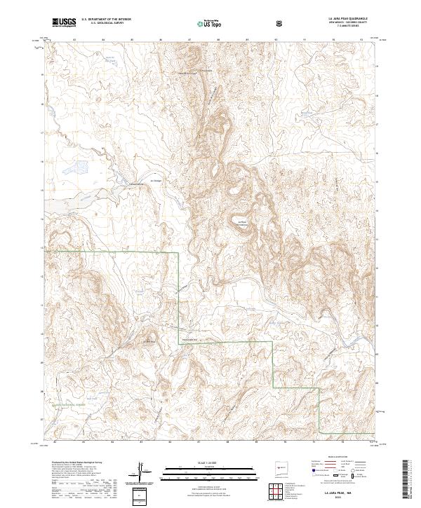
2023 Map of La Jara Peak
USGS Topo · Published 2023About this map
La Jara Peak and the surrounding high desert terrain in Socorro County define this portion of the Cibola National Forest. The landscape is a network of water-dependent landmarks, from the Juan De Dios Tank in the north to numerous natural springs like El Chupadero Spring and Riley Spring that have historically sustained life in this arid environment. Significant elevation markers such as Monument Hill and Sierra Lucero overlook the deep cuts of the Rio Salado and Cañon del Alamito. Primitive routes like Buricito Rd and Cam Sierra Ladrone thread through the canyons and across the Mesa de la Cienaga, tracing paths through a geography defined by its seasonal hydrology and cattle-ranching heritage, evidenced by locations such as Mina Tank and Bull Tank.
Find a feature on this map
33 named features on this map. Tap any name to fly to it.
Don’t see what you’re looking for? This feature index may not catch every label — zoom into the map to look around manually.
Map Details
Editions of this 2023 La Jara Peak Map
This is the sole edition of this map. No revisions or reprints were ever made.
Other maps of this area

1917 · Cerro Verde
USGS Topo · 1:125,000

1954 · Socorro
USGS Topo · 1:250,000

1956 · Mesa Aparejo
USGS Topo · 1:62,500

1958 · Socorro
USGS Topo · 1:250,000

1959 · Riley
USGS Topo · 1:62,500

1962 · Socorro
USGS Topo · 1:250,000

1964 · La Jara Peak
USGS Topo · 1:24,000

1964 · Field Ranch
USGS Topo · 1:24,000

1964 · Puertecito
USGS Topo · 1:24,000
1964 · Puerto De Los Cavadores
USGS Topo · 1:24,000