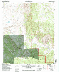
1995 Map of La Jara Peak
USGS Topo · Published 1998About this map
La Jara Peak stands as a prominent high point in this 1995 survey of Socorro County, anchoring a landscape defined by deep canyons and critical water sources. The western portion of the map is dominated by the Cibola National Forest, where the terrain drops sharply into Cañon de los Negros and Carrizozo canyon. This arid environment is punctuated by several named springs and catchments essential for ranching, including El Chupadero Spring, La Jara Spring, and Juan de Dios Tank. Historical land use is evident through the presence of established homesteads such as Benjamin Ranch and the Rancho de los Chavez near Monument Hill. Cattle ranching infrastructure like the Bull Pasture Corral and Alamito Well highlights the region's long-standing connection to livestock management in the high desert of New Mexico.
Find a feature on this map
70 named features on this map. Tap any name to fly to it.
Don’t see what you’re looking for? This feature index may not catch every label — zoom into the map to look around manually.
Map Details
Editions of this 1995 La Jara Peak Map
This is the sole edition of this map. No revisions or reprints were ever made.
Other maps of this area

1917 · Cerro Verde
USGS Topo · 1:125,000

1954 · Socorro
USGS Topo · 1:250,000

1956 · Mesa Aparejo
USGS Topo · 1:62,500

1958 · Socorro
USGS Topo · 1:250,000

1959 · Riley
USGS Topo · 1:62,500

1962 · Socorro
USGS Topo · 1:250,000

1964 · La Jara Peak
USGS Topo · 1:24,000

1964 · Field Ranch
USGS Topo · 1:24,000

1964 · Puertecito
USGS Topo · 1:24,000
1964 · Puerto De Los Cavadores
USGS Topo · 1:24,000