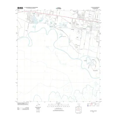
2013 Map of La Joya
USGS Topo · Published 2013About this map
The Rio Grande defines the southern reach of this borderlands region, where shifting river courses have left behind distinctive landforms like Caballeno Banco Number 97 and King Banco Number 48. The landscape is a mix of agricultural infrastructure and residential growth, centered on the settlements of La Joya, Penitas, and Abram. Water management is central to the area's development, evidenced by the Edinburg Pump and the Edinburg Settling Basin near the winding river banks.
Find a feature on this map
87 named features on this map. Tap any name to fly to it.
Don’t see what you’re looking for? This feature index may not catch every label — zoom into the map to look around manually.
Map Details
Editions of this 2013 La Joya Map
This is the sole edition of this map. No revisions or reprints were ever made.
Other maps of this area

1940 · Monte Christo
USGS Topo · 1:62,500

1949 · Mc Allen
USGS Topo · 1:250,000

1954 · McAllen
USGS Topo · 1:250,000

1956 · Garcias
USGS Topo · 1:62,500

1956 · Los Ebanos
USGS Topo · 1:62,500

1957 · Mc Allen
USGS Topo · 1:250,000

1962 · McAllen
USGS Topo · 1:250,000

1963 · La Joya
USGS Topo · 1:24,000

1963 · Citrus City
USGS Topo · 1:24,000
1963 · Alton
USGS Topo · 1:24,000