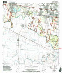
2002 Map of La Joya
USGS Topo · Published 2003About this map
Rio Grande Rio Bravo defines the international boundary between Texas and Tamaulipas, anchoring a landscape of agricultural canals and conservation areas. The northern bank is densely settled with communities such as La Joya, Peñitas, Perezville, and Abram, supported by an extensive network of schools including Tabasco Elem Sch and Chavez Middle Sch. South of the river, the Mexican interior features smaller settlements like Reynosa Díaz, El Triunfo, and El Barranco among a grid of irrigation works like the Canal Principal.
Find a feature on this map
60 named features on this map. Tap any name to fly to it.
Don’t see what you’re looking for? This feature index may not catch every label — zoom into the map to look around manually.
Map Details
Editions of this 2002 La Joya Map
This is the sole edition of this map. No revisions or reprints were ever made.
Other maps of this area

1940 · Monte Christo
USGS Topo · 1:62,500

1949 · Mc Allen
USGS Topo · 1:250,000

1954 · McAllen
USGS Topo · 1:250,000

1956 · Garcias
USGS Topo · 1:62,500

1956 · Los Ebanos
USGS Topo · 1:62,500

1957 · Mc Allen
USGS Topo · 1:250,000

1962 · McAllen
USGS Topo · 1:250,000

1963 · La Joya
USGS Topo · 1:24,000

1963 · Citrus City
USGS Topo · 1:24,000
1963 · Alton
USGS Topo · 1:24,000