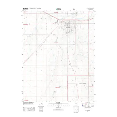
2013 Map of La Junta
USGS Topo · Published 2013About this map
The Arkansas River defines the northern reaches of this Otero County landscape, where the urban grid of La Junta transitions into the expansive terrain of the Comanche National Grassland. This 2013 survey details a high-plains community shaped by its water management systems, including the Catlin Canal and the Otero Canal, which trace the contours of the land alongside natural drainage features like Anderson Arroyo and King Arroyo. Educational and civic foundations are prominent near the city center, specifically Otero Jr Coll and the local Po. To the west and south, the map documents smaller outposts like Ormega and natural landmarks such as Dixie Bluffs. Local history and genealogy are well-represented by the locations of Fairview Cem and the Otero County Cem, while the northern bank of the river highlights the community of North La Junta.
Find a feature on this map
89 named features on this map. Tap any name to fly to it.
Don’t see what you’re looking for? This feature index may not catch every label — zoom into the map to look around manually.
Map Details
Editions of this 2013 La Junta Map
This is the sole edition of this map. No revisions or reprints were ever made.
Other maps of this area

1891 · Catlin
USGS Topo · 1:125,000

1891 · Higbee
USGS Topo · 1:125,000

1891 · Las Animas
USGS Topo · 1:125,000

1891 · Timpas
USGS Topo · 1:125,000

1893 · Higbee
USGS Topo · 1:125,000

1893 · Las Animas
USGS Topo · 1:125,000

1893 · Catlin
USGS Topo · 1:125,000

1894 · Timpas
USGS Topo · 1:125,000

1953 · Cheraw
USGS Topo · 1:24,000

1953 · Hadley
USGS Topo · 1:24,000