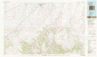
1982 Map of La Junta
USGS Topo · Published 1983About this map
La Junta stands as a vital crossroads on this early 1980s landscape, positioned where the Arkansas River and the Atchison Topeka and Santa Fe railroad meet. The map reveals the deep historical layers of the region, tracing the path of the Santa Fe Trail as it cuts southwest toward Timpas and Bloom. To the south, the terrain transforms as the Purgatoire River carves through a labyrinth of canyons and mesas, including the Black Hills and OV Mesa.
Find a feature on this map
72 named features on this map. Tap any name to fly to it.
Don’t see what you’re looking for? This feature index may not catch every label — zoom into the map to look around manually.
Map Details
Editions of this 1982 La Junta Map
This is the sole edition of this map. No revisions or reprints were ever made.
Other maps of this area

1891 · Catlin
USGS Topo · 1:125,000

1891 · Higbee
USGS Topo · 1:125,000

1891 · Las Animas
USGS Topo · 1:125,000

1891 · Timpas
USGS Topo · 1:125,000

1891 · Nepesta
USGS Topo · 1:125,000

1891 · Apishapa
USGS Topo · 1:125,000

1891 · Springfield
USGS Topo · 1:125,000

1891 · Mesa De Maya
USGS Topo · 1:125,000

1892 · Lamar
USGS Topo · 1:125,000

1892 · Two Butte
USGS Topo · 1:125,000