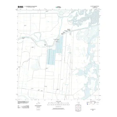
2010 Map of La Leona
USGS Topo · Published 2010About this map
The winding Arroyo Colorado and the expansive wetlands of Cayo Atascoso define this coastal landscape in Cameron County. The map reveals a transition from traditional agricultural holdings like La Leona Ranch, Miradores Ranch, and Rancho Nuevo to modern developments along the water. The clustering of residential areas such as Schwartz Colonia, Coulson Colonia, and Channel Lots Colonia near Arroyo City illustrates the 21st-century growth of communities focused on the river's recreational access.
Find a feature on this map
40 named features on this map. Tap any name to fly to it.
Don’t see what you’re looking for? This feature index may not catch every label — zoom into the map to look around manually.
Map Details
Editions of this 2010 La Leona Map
This is the sole edition of this map. No revisions or reprints were ever made.
Other maps of this area

1929 · Rio Hondo
USGS Topo · 1:24,000

1929 · La Coma
USGS Topo · 1:24,000

1929 · Buena Vista
USGS Topo · 1:24,000

1930 · La Leona
USGS Topo · 1:24,000

1930 · Laguna Atascosa
USGS Topo · 1:24,000

1932 · Rio Hondo
USGS Topo · 1:31,680

1933 · Paso Real
USGS Topo · 1:31,680

1934 · La Coma
USGS Topo · 1:31,680

1935 · Buena Vista
USGS Topo · 1:31,680

1936 · La Leona
USGS Topo · 1:31,680
Featured Places
- Schwartz Colonia, TX
- XX Farms Colonia, TX
- Arroyo City, TX
- Arroyo City Subdivision Colonia, TX
- La Leona, TX