
1936 Map of La Leona
USGS Topo · Published 1936About this map
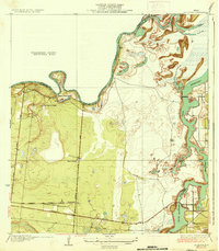
La Leona serves as a central point in this South Texas coastal landscape, where the Missouri Pacific railroad cuts across the southern portion of the survey. The environment is dominated by the winding course of the Arroyo Colorado, which forms the boundary with Willacy County. This 1930s survey reveals a region of large-scale landholdings, characterized by numerous named ranching outposts such as Boca Chica Ranch, Los Coyotes Ranch, and Nuevo Ranch. The presence of the Cayo Atascoso and the Resaca de los Cuates highlights the complex hydrology of the lower Rio Grande Valley, showing a network of ephemeral water channels and resacas typical of the era's natural drainage before extensive modern modification. Primary transit is defined by straightened tracks like Paredes Line Road and North Road, which connected these isolated agricultural headquarters to the rail line at the La Leona Ranch.
Find a feature on this map
16 named features on this map. Tap any name to fly to it.
Don’t see what you’re looking for? This feature index may not catch every label — zoom into the map to look around manually.
Map Details
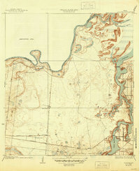
Editions of this 1936 La Leona Map
3 editions found
Other maps of this area

1929 · Rio Hondo
USGS Topo · 1:24,000

1929 · La Coma
USGS Topo · 1:24,000

1929 · Buena Vista
USGS Topo · 1:24,000

1930 · La Leona
USGS Topo · 1:24,000

1930 · Laguna Atascosa
USGS Topo · 1:24,000

1932 · Rio Hondo
USGS Topo · 1:31,680

1933 · Paso Real
USGS Topo · 1:31,680

1934 · La Coma
USGS Topo · 1:31,680

1935 · Buena Vista
USGS Topo · 1:31,680
1936 · Laguna Atascosa
USGS Topo · 1:31,680
Featured Places
- Coulson Colonia, TX
- Rancho Nuevo, TX
- Arroyo City Subdivision Colonia, TX
- La Leona, TX
- Los Coyotes Ranch, TX