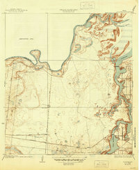
1936 Map of La Leona
USGS Topo · Published 1945About this map
La Leona and a network of family-named ranchlands define this coastal South Texas landscape as it appeared following the 1929-1930 survey. The territory is marked by the winding course of the Arroyo Colorado and the intricate tidal waters of the Cayo Atascoso, where channel definitions remain shifting and indefinite. This region in Cameron County shows a transitional era of transportation, where the Missouri Pacific and Fernando railroads run parallel to early motor routes like the Paredes Line Road. Large landholdings such as Boca Chica Ranch, Los Coyotes Ranch, and La Leona Ranch indicate a sparse, ranching-based settlement pattern near the Willacy County line. The topography also highlights natural features like the Resaca de los Cuates, illustrating the specific hydrology of the Rio Grande delta.
Find a feature on this map
17 named features on this map. Tap any name to fly to it.
Don’t see what you’re looking for? This feature index may not catch every label — zoom into the map to look around manually.
Map Details
Editions of this 1936 La Leona Map
3 editions found
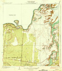
Other maps of this area

1929 · Rio Hondo
USGS Topo · 1:24,000

1929 · La Coma
USGS Topo · 1:24,000

1929 · Buena Vista
USGS Topo · 1:24,000

1930 · La Leona
USGS Topo · 1:24,000

1930 · Laguna Atascosa
USGS Topo · 1:24,000

1932 · Rio Hondo
USGS Topo · 1:31,680

1933 · Paso Real
USGS Topo · 1:31,680

1934 · La Coma
USGS Topo · 1:31,680

1935 · Buena Vista
USGS Topo · 1:31,680

1936 · La Leona
USGS Topo · 1:31,680
Featured Places
- Coulson Colonia, TX
- Rancho Nuevo, TX
- Arroyo City Subdivision Colonia, TX
- La Leona, TX
- Los Coyotes Ranch, TX