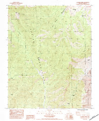
1984 Map of La Madre Spring
USGS Topo · Published 1984About this map
The Spring Mountains of southern Nevada dominate this 1980s provisional survey, revealing a landscape defined by sharp elevation changes and critical water sources. Within the Toiyabe National Forest, the map traces the deep incision of Lovell Canyon and the prominent heights of Harris Mtn. The eastern portion of the sheet transitions into the Red Rock Canyon Lands Recreation Area, where the massive Sandstone Bluffs and La Madre Mtn create a stark geological boundary.
Find a feature on this map
26 named features on this map. Tap any name to fly to it.
Don’t see what you’re looking for? This feature index may not catch every label — zoom into the map to look around manually.
Map Details
Editions of this 1984 La Madre Spring Map
2 editions found
Other maps of this area

1907 · Las Vegas
USGS Topo · 1:250,000

1908 · Las Vegas
USGS Topo · 1:250,000

1952 · Corn Creek Springs
USGS Topo · 1:62,500

1952 · Blue Diamond
USGS Topo · 1:62,500

1954 · Las Vegas
USGS Topo · 1:250,000

1957 · Las Vegas
USGS Topo · 1:250,000

1957 · Charleston Peak
USGS Topo · 1:62,500

1957 · Mountain Springs
USGS Topo · 1:62,500

1959 · Las Vegas
USGS Topo · 1:250,000

1962 · Las Vegas
USGS Topo · 1:250,000