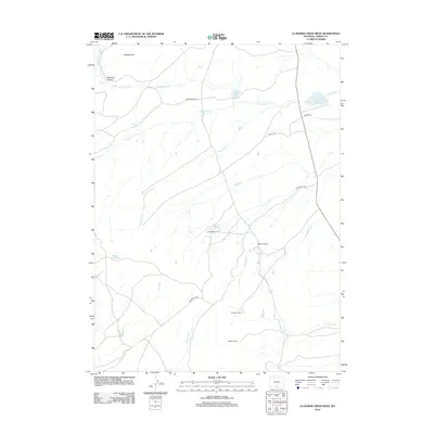
2012 Map of La Marsh Creek West
USGS Topo · Published 2012About this map
Atlantic Rim defines the western heights of this high-country landscape in Carbon County, where seasonal drainages and isolated ranching operations mark the terrain. The 2012 topography shows a network of named family holdings, including Lambertsen Ranch, McCarthy Ranch, and the LaMarsh Ranch near the southern boundary. These sites are linked by historic transit routes such as Bridger Pass Rd and Bolter Rd, reflecting the enduring ranching economy of this part of Wyoming.
Find a feature on this map
21 named features on this map. Tap any name to fly to it.
Don’t see what you’re looking for? This feature index may not catch every label — zoom into the map to look around manually.
Map Details
Editions of this 2012 La Marsh Creek West Map
This is the sole edition of this map. No revisions or reprints were ever made.
Other maps of this area

1932 · Savery
USGS Topo · 1:96,000

1940 · Savery
USGS Topo · 1:125,000

1954 · Rawlins
USGS Topo · 1:250,000

1956 · Bridger Pass
USGS Topo · 1:62,500

1956 · Bolten Ranch
USGS Topo · 1:62,500

1958 · Rawlins
USGS Topo · 1:250,000

1961 · Middlewood Hill
USGS Topo · 1:24,000

1961 · Pine Grove Ranch
USGS Topo · 1:24,000

1961 · Pole Gulch
USGS Topo · 1:24,000

1962 · Rawlins
USGS Topo · 1:250,000