
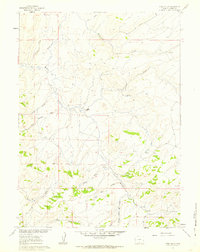
1961 Map of Pole Gulch
USGS Topo · Published 1963About this map
The Emigrant Trail Bridger Pass Road cuts through this high desert landscape of Carbon County, tracing a historic path of westward expansion. Surveyed in the early 1960s, the terrain is defined by a network of drainage systems like Muddy Creek and McKinney Creek that feed into the larger river basin. Evidence of early land claims and ranching life is preserved at the McKeen Homestead, situated near the confluence of local draws. The geography is characterized by rugged depressions such as Pole Gulch and Horse Draw, which lead toward the rising elevations of the Sierra Madre. Small water sources, including a Flowing Well and several unnamed springs, provided essential relief in an area primarily accessible via a Jeep Trail. This survey captures the region just before modern developments, maintaining the footprint of the old trails that once guided pioneers across the Continental Divide.
Find a feature on this map
21 named features on this map. Tap any name to fly to it.
Don’t see what you’re looking for? This feature index may not catch every label — zoom into the map to look around manually.
Map Details
Editions of this 1961 Pole Gulch Map
2 editions found
Other maps of this area

1932 · Savery
USGS Topo · 1:96,000

1940 · Savery
USGS Topo · 1:125,000

1954 · Rawlins
USGS Topo · 1:250,000

1956 · Bridger Pass
USGS Topo · 1:62,500

1957 · Doty Mountain
USGS Topo · 1:62,500

1958 · Rawlins
USGS Topo · 1:250,000

1961 · Pine Grove Ranch
USGS Topo · 1:24,000

1961 · Ketchum Buttes
USGS Topo · 1:24,000
1961 · Mc Carty Ranch
USGS Topo · 1:24,000

1962 · Rawlins
USGS Topo · 1:250,000