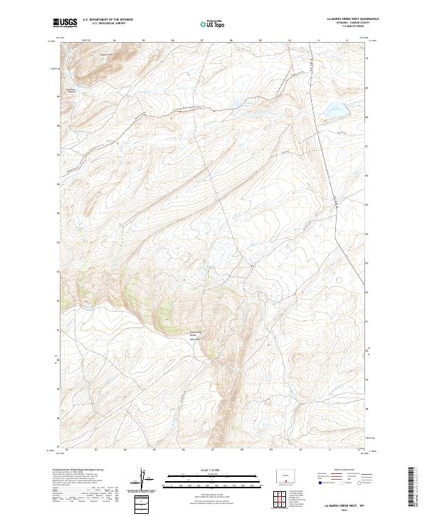
2021 Map of La Marsh Creek West
USGS Topo · Published 2021About this map
Continental Divide winds through this Carbon County landscape, defining the watershed where numerous seasonal and perennial creeks emerge. The high ground of the Atlantic Rim and Miller Hill provides a dramatic backdrop for a network of remote ranching and access roads, including the historic path of Bridger Pass Rd. Water management is central to the area’s utility, evidenced by the Little Sage Cr Dam, Teton Reservoir, and Miller Hill Lake. The Continental Divide National Scenic Trl traverses the northern and central sections, following the ridgeline between Beckman Canyon and the headwaters of Miller Cr. This terrain is deeply etched by drainages like Deadman Cr and Pine Grove Cr, illustrating the complex hydrology of the high desert plateau.
Find a feature on this map
27 named features on this map. Tap any name to fly to it.
Don’t see what you’re looking for? This feature index may not catch every label — zoom into the map to look around manually.
Map Details
Editions of this 2021 La Marsh Creek West Map
This is the sole edition of this map. No revisions or reprints were ever made.
Other maps of this area

1932 · Savery
USGS Topo · 1:96,000

1940 · Savery
USGS Topo · 1:125,000

1954 · Rawlins
USGS Topo · 1:250,000

1956 · Bridger Pass
USGS Topo · 1:62,500

1956 · Bolten Ranch
USGS Topo · 1:62,500

1958 · Rawlins
USGS Topo · 1:250,000

1961 · Middlewood Hill
USGS Topo · 1:24,000

1961 · Pine Grove Ranch
USGS Topo · 1:24,000

1961 · Pole Gulch
USGS Topo · 1:24,000

1962 · Rawlins
USGS Topo · 1:250,000