
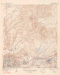
1947 Map of La Mesa
USGS Topo · Published 1947About this map
Mission Valley and the growing eastern suburbs of San Diego are documented in this late-1930s survey, showing the transition from agricultural and open terrain to organized residential tracts. The grid systems of Normal Hts, Kensington Park, and East San Diego dominate the lower-left, where schools like Hoover High Sch and John Adams Sch serve the expanding population. To the east, State College is established atop the mesas, while the City of La Mesa and Spring Valley appear as more distant developments connected by the San Diego and Arizona Eastern rail line.
Find a feature on this map
36 named features on this map. Tap any name to fly to it.
Don’t see what you’re looking for? This feature index may not catch every label — zoom into the map to look around manually.
Map Details
Editions of this 1947 La Mesa Map
2 editions found
Other maps of this area

1893 · El Cajon
USGS Topo · 1:62,500

1901 · Elcajon
USGS Topo · 1:62,500

1903 · Cuyamaca
USGS Topo · 1:125,000

1903 · La Jolla
USGS Topo · 1:62,500

1903 · Elcajon
USGS Topo · 1:62,500

1904 · San Diego
USGS Topo · 1:62,500

1904 · Southern California Sheet No. 2
USGS Topo · 1:250,000

1930 · La Jolla
USGS Topo · 1:62,500

1930 · San Diego
USGS Topo · 1:62,500

1939 · El Cajon
USGS Topo · 1:62,500