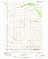
1975 Map of La Moille
USGS Topo · Published 1978About this map
Minerva Creek and the Iowa River dominate the landscape of Marshall County in the mid-1970s, carving paths through the agricultural heartland of central Iowa. The village of La Moille serves as a small rail hub along the Chicago and North Western line, while dispersed rural communities like Minerva and Moningers are defined by their proximity to the waterways. The presence of the County Home and several small cemeteries, such as Hixite Cem and Marietta Cem, provides a detailed record of the area's local history and social structure.
Find a feature on this map
25 named features on this map. Tap any name to fly to it.
Don’t see what you’re looking for? This feature index may not catch every label — zoom into the map to look around manually.
Map Details
Editions of this 1975 La Moille Map
This is the sole edition of this map. No revisions or reprints were ever made.
Other maps of this area

1954 · Waterloo
USGS Topo · 1:250,000

1954 · Des Moines
USGS Topo · 1:250,000

1955 · Waterloo
USGS Topo · 1:250,000

1956 · Des Moines
USGS Topo · 1:250,000

1957 · Des Moines
USGS Topo · 1:250,000

1960 · Marshalltown
USGS Topo · 1:24,000

1960 · Marshalltown
USGS Topo · 1:62,500

1960 · Conrad West
USGS Topo · 1:24,000

1969 · Des Moines
USGS Topo · 1:250,000

1975 · State Center NW
USGS Topo · 1:24,000