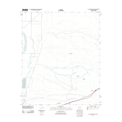
2011 Map of La Paz Mountain
USGS Topo · Published 2011About this map
Morgantown stands at the southern edge of this arid landscape where the Colorado River corridor meets the desert floor of La Paz County. The terrain is defined by a series of alluvial drainage systems, including the extensive Seventy Wash and La Paz Wash, which carve through the plains below La Paz Mountain. The mapping reveals a sparse network of roads like the Ehrenberg Poston Hwy and Patch Mine Rd that provide access to remote desert locations such as Sunshine Gulch and Martinez Gulch. The presence of the Goodman Slough and Goodman Tank indicates the vital importance of water management in this environment. This survey captures a moment of transition where established routes like Tom Wells Rd and Weir Rd bridge the gap between the river lowlands and the rugged backcountry gulches.
Find a feature on this map
21 named features on this map. Tap any name to fly to it.
Don’t see what you’re looking for? This feature index may not catch every label — zoom into the map to look around manually.
Map Details
Editions of this 2011 La Paz Mountain Map
This is the sole edition of this map. No revisions or reprints were ever made.
Other maps of this area

1931 · Moon Mtn
USGS Topo · 1:62,500

1932 · Moon Mtn
USGS Topo · 1:62,500

1933 · Cunningham Mtn
USGS Topo · 1:48,000

1940 · Dome Rock Mts
USGS Topo · 1:62,500

1942 · Blythe
USGS Topo · 1:250,000

1942 · MOON MTN
USGS Topo · 1:62,500

1945 · Big Maria Mtns
USGS Topo · 1:62,500

1951 · Big Maria Mts
USGS Topo · 1:62,500

1951 · Blythe
USGS Topo · 1:24,000

1951 · Blythe NE
USGS Topo · 1:24,000